November 8, 2023
Authors

Procurement and risk-sharing mechanisms may be key to reducing construction arbitration claims
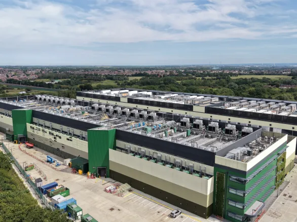
Known for its diverse topography and range of untapped natural resources, Latin America has the potential to become a key player in renewable energy — especially solar power. Currently, if 319 gigawatts of construction projects planned for the next seven years come to fruition, the region could increase its utility-scale solar and wind power capacity by more than 460% by 2030, becoming one of the world's largest renewable energy producers.
Latin America also holds the potential to help other countries progress toward their goals for cleaner, greener energy production. As an established source of several minerals essential for technology development, such as graphite, nickel, manganese, and other rare earth elements, Latin America carries the potential to play a global role in combatting climate change, given increased investment in mining operations.
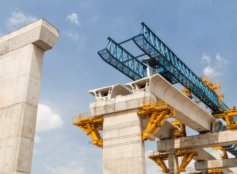
To get there, however, the region will need to resolve substantial infrastructure gaps in energy and other key sectors like sanitation, communication, logistics, and housing, with infrastructure investment estimated at just 2.5% of the region's GDP in 2019. To meet the UN's Sustainable Development Goals by 2030, Latin America needs to invest over $2.2 trillion, with 59% allocated to new infrastructure and 41% for the maintenance and replacement of existing assets.
Large construction projects in Latin America face climate change, socioeconomic, and political challenges
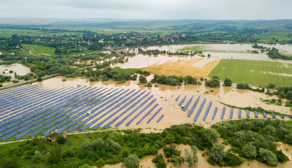
While climate-related extreme weather events have magnified the frequency and impacts of geotechnical and geological hazards, or "geohazards" — like landslides, subsidence, erosion, and flooding — such factors have long posed an inherent risk for construction projects in Latin America. The presence and effects of these geohazards are exacerbated by natural conditions such as the region's location along the Andes chain and the Circum-Pacific Ring of Fire, its complicated topography, and varying ground conditions. The impact of climate change is especially pronounced in Latin America and the Caribbean due to large, underdeveloped areas and challenges in maintaining infrastructure.
When stakeholders encounter site conditions that differ substantially from what they expected and a claim ensues, the consequences can be significant, leading to schedule delays, cost increases, dangerous working conditions, and invalid design assumptions.
Socioeconomic issues and political challenges can also increase uncertainty in the characterization of site conditions. For example, unauthorized or undocumented occupied land can limit access, inhibiting site investigations; a lack of records regarding site conditions can prevent underground structures from being discovered before construction starts; and the sometimes unstable political landscape can impose constraints on projects. These challenges can be addressed, and their consequences mitigated with adequate planning and implementation of a robust site investigation program.
Collectively, navigating the construction industry in the region can be challenging, with increasing project costs and delays associated with encountering differing site conditions (DSCs) or unforeseeable physical conditions and other geohazards ("riesgos geológicos/geotécnicos") that end up in large claims or arbitration processes.
Analyzing these complex claims and addressing their impact requires robust technical expertise and geotechnical and geological assessments to help contractual parties determine the merits of claims. Building strategies into contractual terms that acknowledge project-related geotechnical and geological hazards, socioeconomic and political challenges, and weather-driven consequences can go a long way toward minimizing claims and avoiding arbitration in the first place. With both parties positioned through pre-agreed terms, it is possible to reduce friction among stakeholders and reduce project interruptions.
The rising tide of geotechnical uncertainty
Increases in temperature and the multiplying number of extreme weather events in Latin America are having a direct impact on the frequency and severity of floods, landslides, droughts, sea-level rise, coastal erosion, and storm surges, intensifying geotechnical and geological hazards.
For example, in the Caribbean region, hurricanes have increased in frequency and intensity over the past 20 years as sea surface temperatures have risen. In addition, some experts anticipate that global warming will intensify El Niño, a natural climate phenomenon, resulting in even more significant damages in the future — larger than its approximately 1.7 billion-dollar impact on transportation in Latin America in 1997. With the National Oceanic and Atmospheric Administration declaring the beginning of a new El Niño through the Northern Hemisphere in 2023 (with an 80% chance of El Niño occurring during March-May 2024), the near-term challenges will likely increase impacts to Latin America's existing geotechnical challenges over the next year.
These challenges have the potential to exacerbate a variety of hazards with structural effects, including:
| Climate Threat | Geotechnical & Structural Impact |
| Increased rainfall and storms |
|
| Strong winds and gales |
|
| Droughts and wildfires |
|
| Increased mean sea level and storm surge heights |
|
| Higher temperatures |
|
Changes in climate and extreme weather events, which are based on the analysis of historical climate data, will also complicate predictions about future climate behavior, increasing risks and uncertainty. Dealing with these uncertain changes in climate requires building flexibility into specific project types, e.g., transportation systems, to avoid assets underperforming over time. This context will affect the planning, procurement, and construction of new assets, requiring careful consideration and adjustments in investment by a variety of stakeholders.
Attempts to protect infrastructure from extreme weather have come a long way — and continue to reflect important innovations. For example, climate-resilient construction materials (e.g., heat-resistant epoxy-based pavements or graphene-based concrete) and the application of artificial intelligence to enhance geotechnical design are key developments.
However, despite technological innovations, weather-related force majeure claims, which excuse one of the parties from meeting certain targets based on the occurrence of events that can be defined as abnormal or unpredictable, are expected to increase. Establishing force majeure claims based on weather conditions, apart from exceptional and catastrophic occurrences like hurricanes or earthquakes, can be challenging due to disagreement over the foreseeability of those weather-related events.
Planning and designing for geotechnical and geological uncertainty
Unforeseen physical conditions encountered during construction are a common source of claims in Latin America and will continue due to the region's problems with site accessibility (such as geographical impediments or access restrictions), financial constraints, organizational structure and leadership culture, procurement challenges, human capital deficits, relationship challenges, and underdeveloped infrastructure. The increased frequency of climate-related events like El Niño are only likely to exacerbate the frequency and consequences of geohazards.
One way to mitigate the effects or severity of potential claims stemming from differing site conditions, unforeseen physical conditions, and "riesgos geológicos/geotécnicos" is for contractual parties to proactively and explicitly address geotechnical and geological hazards and their weather-related expectations in contract terms that clearly allocate risks to the party that can better manage and control those risks. When this is not feasible, the risk should be distributed according to clearly defined contractual terms. Accounting for the likelihood of these impacts can effectively help establish a mechanism for requesting compensation or time extensions for delays for a predetermined category of unforeseen events.
For example, geotechnical baseline reports (GBR) were designed specifically to address geotechnical uncertainty. Contained in the International Federation of Consulting Engineers (FIDIC) standard form of contract for underground works (the Emerald Book), a detailed GBR describes anticipated subsurface conditions and clarifies the allocation of risk with the intent of avoiding and resolving ground-related disputes.
Another risk-sharing mechanism is a parametric-based insurance policy, which has been used by the insurance industry for many years and could be considered in other contractual agreements. This insurance coverage allows for payment to the insured when predefined triggers are exceeded, based on specific weather metrics, such as wind speed, ground shaking, or temperature.

Complicated claims require complex, multidisciplinary technical assessments
When stakeholders encounter site conditions that differ substantially from what they expected and a claim ensues, the consequences can be significant, leading to schedule delays, cost increases, dangerous working conditions, and invalid design assumptions. Such claims, however, often have roots in some common optimistic assumptions among owners, designers, and contractors that precede a surprise discovery. Ground characteristics can be highly variable, and it is not always possible to anticipate the exact conditions that will be encountered at a given location, requiring designers and contractors to make assumptions — sometimes unsupported or contradicted by the available data — that can lead them to present inadequate bids in terms of time and costs.
Due to the complexity of construction claims, it is critical to have expertise in collecting and evaluating data through literature studies, site investigations, and scientific and engineering analyses performed in the context of contractual requirements and Latin American realities. This process will help stakeholders understand the full context of the dispute and determine whether the described conditions are accurate, whether they could have been identified earlier, and whether the measures taken were appropriate for what was encountered. Addressing these issues requires multifaceted analytical strategies.
Construction projects in Latin America face an assortment of challenges, including bridging the infrastructure gap, geotechnical problems, and climate change.
Subsurface investigations
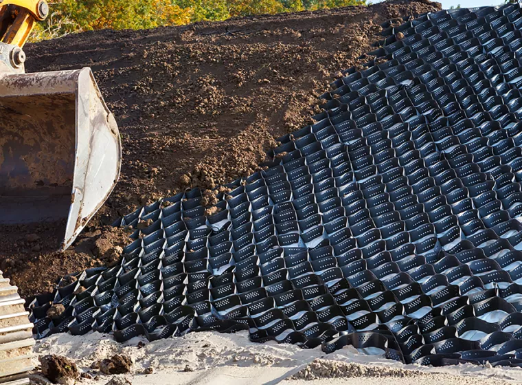
Geotechnical design and construction risks can be mitigated through the implementation of a sound subsurface investigation plan that includes excavations (trench and test pits), borings, geophysical surveys, and soil sampling. In many cases, it is not possible or economically feasible to perform site investigations due to constraints such as geographical impediments, access restrictions, and unsafe conditions.
While taking the right quantity of samples to accurately characterize subsurface conditions is key, ensuring the quality of those investigations by evaluating whether subsurface explorations were properly performed and interpreted and analyzing the implications and importance of various tests is essential. For instance, if the project owner's geotechnical consultant for construction of a high-rise building neglects to follow the standard of care for ensuring that the soil can support a high-rise foundation and does not drill down to the minimum depth of influence, this could be considered a deficient exploration and could serve as the basis of a valid claim.
Compliance with standards
The requirements for investigation of site conditions are typically completed in accordance with known standards. Those standards are often explicitly cited in contractual requirements (e.g., British Standards, AASHTO, local and national standards). The minimum subsurface investigation requirement often includes items such as the minimum number of excavations or borings, minimum distance between investigation points, and minimum depths of exploration, as well as the types of in situ and laboratory tests to be performed, etc.
Compliance can be greatly aided by a team of civil engineers and geologists who can interpret and evaluate the required standards; assess whether they were followed in the investigation, design, and construction of infrastructure projects; and assess the impact and consequences of potential deviations from those standards.
Remote-sensing analysis
Remote sensing is the process of detecting and monitoring the physical characteristics of an area or an object from a distance without physical contact. Recent technological advancements have made powerful sensing instruments a fundamental part of modern-day society, including GPS, aerial photography, aircraft radar, and autonomous vehicle laser scanners. More importantly, they have created unprecedented potential for today's most challenging problems to be evaluated effectively, from understanding climate change to predicting natural hazards and analyzing the effects of anthropogenic processes.
A region of promise and potential
Construction projects in Latin America face an assortment of challenges, including bridging the infrastructure gap, geotechnical problems, and climate change. Technological innovation will play a crucial role in reducing and mitigating those risks. However, effective procurement strategies with clear risk — and uncertainty — sharing mechanisms are key to enticing governments, investors, designers, and contractors to undertake infrastructure projects in the region.

What Can We Help You Solve?
Our multidisciplinary team of civil engineers, geologists, and construction consultants provides objective analysis of differing site conditions, unforeseen physical conditions, and related claims. We can evaluate the technical merits of claims; evaluate cost/delay impacts; conduct subsurface explorations and geologic mapping; and offer expert testimony at review board hearings, arbitrations, mediations, and trials.
![Mining [CE]](/sites/default/files/styles/cards_home_card/public/media/images/GettyImages-1139148636.jpg.webp?itok=UlJkqJCd)
Differing Site Conditions
Objective analysis for all aspects of DSC claims.

External Hazards: Risk Assessment & Mitigation
Accurate assessment, mitigation, and remediation support for external hazards and natural disasters.
Earth Structures
Decades of experience addressing the multitude of complex challenges that can arise when earth and engineering meet.
Design & Construction Consulting
Extensive civil engineering expertise to empower decision-making and help reduce design and construction risks and failures.